
US strategic ambiguity: map of India with PoK and Aksai Chin posted, then deleted
The United States Trade Representative (USTR) has deleted a social media post that showed a map of India including Pakistan‑occupied Kashmir (PoK) and the Aksai Chin region as part of Indian territory, drawing international attention and diplomatic discussion. The map was posted on 7 February 2026 and removed on 11 February 2026 , meaning it remained online for about four days before deletion - roughly 96 hours .
It is common practice for the USTR to include maps of partner countries when announcing bilateral trade agreements, and maps of other nations such as Argentina and Bangladesh remain accessible on the USTR’s official social media accounts. These maps typically follow long‑established international conventions and may mark disputed regions with clear demarcations.
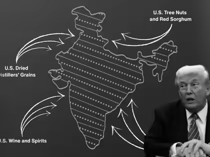
Last week, the USTR shared details of a framework for the first phase of the interim India‑US trade agreement on platform X , accompanied by a map of India. This map depicted the entire region of Jammu and Kashmir, including PoK, and the Aksai Chin region claimed by China, as integral parts of India , departing from the United States’ traditional practice of showing disputed territories with distinct lines or markers.
The USTR deleted the post from its official account without any public explanation , ending speculation about whether the map reflected a deliberate policy shift or was an inadvertent oversight.
Observers and analysts have offered different interpretations of the episode. Some noted that the initial map may have been a symbolic diplomatic nod to India’s territorial claims at a moment of strengthening bilateral ties, especially following months of trade tensions.
India has consistently maintained that the entire Union Territory of Jammu and Kashmir, including PoK, is an inalienable part of the country and also asserts its claim over Aksai Chin.Pakistan administers PoK and rejects India’s sovereignty over it, while China controls Aksai Chin and asserts its own claim over the territory. Most other countries treat these regions as disputed and reflect that status on official maps.
China , for its part, has released its own “standard maps” that include claims over Arunachal Pradesh, Aksai Chin, Taiwan, and parts of the South China Sea, reflecting its official territorial posture but remaining not universally recognized internationally .
The deletion of the map occurred against the backdrop of broader economic engagement: the interim India‑US trade framework outlines reciprocal reductions in tariffs and easing of trade tensions , with reports noting that U.S. tariffs on Indian goods may fall from around 50 percent to approximately 18 percent - the lowest rate Washington has offered to any Asian partner .
The incident underscores how territorial representations in diplomatic graphics can carry political weight , especially in regions where historical disputes are deeply sensitive. The USTR’s initial posting and subsequent removal of the map illustrate the United States’ strategic ambiguity - a diplomatic balancing act between signaling support to India and maintaining broader relationships with Pakistan and China.