
Peru's 6.7 Earthquake Leaves Trail Of Damage Across Southern Andes
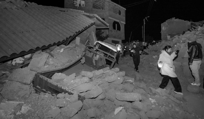
A powerful 6.7 magnitude earthquake that shook Peru's southern Andes has left at least two people injured and caused damage to homes, health centres and a school, authorities said as assessments continued in the affected regions.
The earthquake struck at around 1 pm local time on Thursday, with the US Geological Survey (USGS) placing its epicenter about 38 kilometres northwest of Upahuacho in the Parinacochas province of the Ayacucho region. The quake occurred at a depth of about 66 kilometres.
The tremors were felt across a wide area of Peru, including Ica, Arequipa, Huancavelica, Apurimac and Cusco, and were also felt in the capital, Lima.
Officials said the two injuries were reported in Coracora, the capital of Parinacochas province, where the victims were hurt while evacuating their homes during the earthquake.
The initial reports of no major damage were later followed by confirmation of structural impact. Authorities said 22 homes, six health centres and one school suffered damage across several districts in Ayacucho and Cusco. The affected areas included Puquio, Pullo, Coracora, Upahuacho, San Pedro and Pichari.
Authorities also reported rockfalls on hillsides near Coracora, adding to concerns in the mountainous region as officials continued to assess vulnerable areas.
Despite the strength of the earthquake, Peru's Navy confirmed that there was no tsunami threat.
Peru is located along the seismically active Pacific Ring of Fire, making earthquakes a frequent occurrence. The latest tremor has also revived memories of the devastating 7.9 magnitude earthquake in 2007, which struck the Ica region and killed nearly 600 people.
The USGS measured the latest earthquake at magnitude 6.7, while Peru's Geophysical Institute initially reported a higher 7.2 magnitude, reflecting differing early assessments of the same seismic event.