
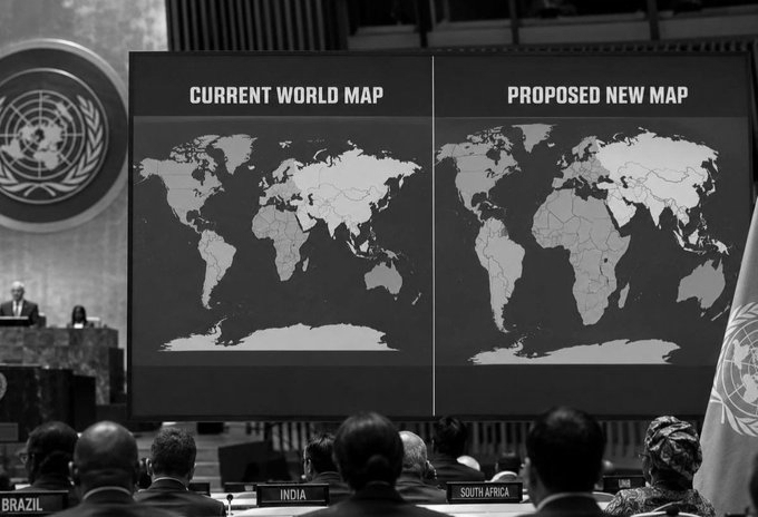
India Backs New World Map As US Stands Alone Against UN ‘Correct The Map’ Vote
The United Nations General Assembly has adopted a resolution encouraging wider use of a world map that more accurately shows the true size of continents, particularly Africa and the Global South, challenging distortions linked to the widely used Mercator projection.
The “Correct the Map” resolution, sponsored by Togo on behalf of the African Group and backed by the African Union, was adopted Friday with 164 countries voting in favour. The United States was the only country to vote against, while Estonia, Georgia, Lithuania, Moldova, Serbia and Ukraine abstained. India also voted in favour.
The initiative encourages a shift from the Mercator projection, created by Flemish cartographer Gerardus Mercator in 1569 for maritime navigation. While it preserves direction, it enlarges landmasses towards the poles and makes equatorial regions appear relatively smaller.
The distortion is clear in comparisons between Africa and Greenland. They can appear similar in size on Mercator maps, although Africa is about 14 times larger, covering roughly 30.3 million square kilometres compared with Greenland’s 2.1 million square kilometres.
The resolution promotes the Equal Earth projection, developed in 2018 by Bojan Šavrič, Tom Patterson and Bernhard Jenny. As an equal-area projection, it shows continents according to their actual relative surface areas while limiting shape distortion. Africa therefore appears substantially larger, while high-latitude regions appear smaller. The aim is not to make Africa “bigger”, but to represent its actual geographical scale more accurately.
Togo’s Foreign Affairs Minister Robert Dussey said the issue was scientific rather than political, arguing that scientific evidence requires countries to accept geographical reality.
Togo and the African Union also say distorted maps have lasting cognitive, educational, cultural, geopolitical and socioeconomic effects, contributing to an underestimation of Africa and other Global South regions. AU Commission Chairperson Mahmoud Ali Youssouf called the vote a step towards representing Africa according to “objective and scientifically established realities” and urged institutions, schools, publishers and digital platforms to adopt more accurate maps.
The AU concluded: “Africa must be represented as it truly is: in its true dimensions and in its rightful place in the world.”
The campaign also challenges colonial-era representations, with critics describing Mercator’s visual effect as “cartographic colonialism” because it can magnify Northern Hemisphere countries while diminishing equatorial regions. France backed the initiative, with Foreign Minister Jean-Noël Barrot saying it would move towards maps more faithful to actual surface areas.
The US opposed the resolution, reportedly calling it unnecessary and objecting to what Washington saw as an ideological agenda.
The decision does not ban Mercator. UN General Assembly resolutions of this kind are non-binding, and Mercator can continue to be used for maritime navigation. The resolution instead encourages equal-area maps for education, public communication and area comparisons.
Togo plans to update school geography materials by the end of 2026 and discuss wider adoption with the African Union and mapping and location-service companies. The vote could eventually influence classrooms, textbooks, media, public institutions and digital platforms, though adoption will remain voluntary.