
Cyclone Senyar: Tamil Nadu, Andhra Pradesh, Odisha on watch
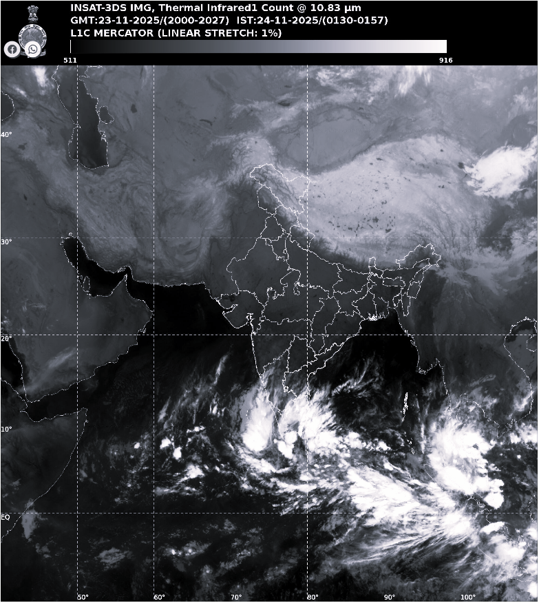
The India Meteorological Department (IMD) on Sunday indicated that a low-pressure area over the Bay of Bengal is expected to intensify into a depression over the southeast Bay of Bengal and the adjoining south Andaman Sea by November 24. IMD scientist Dr. Sanjeev Dwivedi stated that the system is likely to move in a west-northwest direction and may further strengthen into a cyclonic storm.
Dr. Dwivedi also clarified that despite the gradual intensification, Odisha is expected to experience dry weather for the next seven days, with no direct cyclonic influence projected over the state. The low-pressure system, earlier positioned over the Strait of Malacca and the adjoining Andaman region, is now likely to consolidate into a depression over the South Andaman Sea on November 24. Forecast models indicate potential evolution into a cyclonic storm over the southwest Bay of Bengal, although no landfall forecast has yet been issued.
Rainfall activity was reported across Tamil Nadu and Puducherry on Sunday under the influence of the developing system. The Regional Meteorological Centre in Chennai issued a yellow nowcast warning for light to moderate rain accompanied by thunderstorms and lightning until 10 a.m. on November 23. Districts including Kanyakumari, Mayiladuthurai, Nagapattinam, Tenkasi and Thiruvarur, along with the Karaikal region, were expected to be affected. Authorities cautioned that waterlogging, slippery roads and disruptions to local traffic could occur in vulnerable areas. Moderate rainfall was recorded across several parts of Puducherry, including Beach Road, New Bus Stand, Uppalam, Nellithope, Kamaraj Nagar and rural pockets such as Villiyanur, Pakur, Thirubhuvanai and Osudu.
Amid these official assessments, popular weather tracker Telangana Weatherman outlined two key possibilities for Cyclone Senyar’s development. He noted that if the system forms on time between November 26 and 28, it is likely to move towards Central and North Andhra Pradesh, bringing moderate rainfall to East Telangana and light showers to other parts, including Hyderabad, without triggering coldwave conditions. However, if the formation is delayed to between November 28 and 30, the system could intensify into a stronger cyclone but may recurve towards Odisha, Bangladesh or Myanmar a scenario that would leave Telangana and Andhra Pradesh with dry weather and the return of coldwave conditions.
If the system ultimately intensifies into a cyclonic storm, coastal regions of Tamil Nadu, Andhra Pradesh and Odisha are expected to face the highest impact. Early meteorological assessments suggest that the projected west-northwest movement could bring heavy rain, strong winds and rough sea conditions to these states. Cyclonic systems forming in the Bay of Bengal during this season have historically influenced the southern and eastern coastlines, placing these regions under heightened observation.