
Cartographic Inaccuracies: Nepal Airlines Apologises For Map Showing J&K In Pakistan
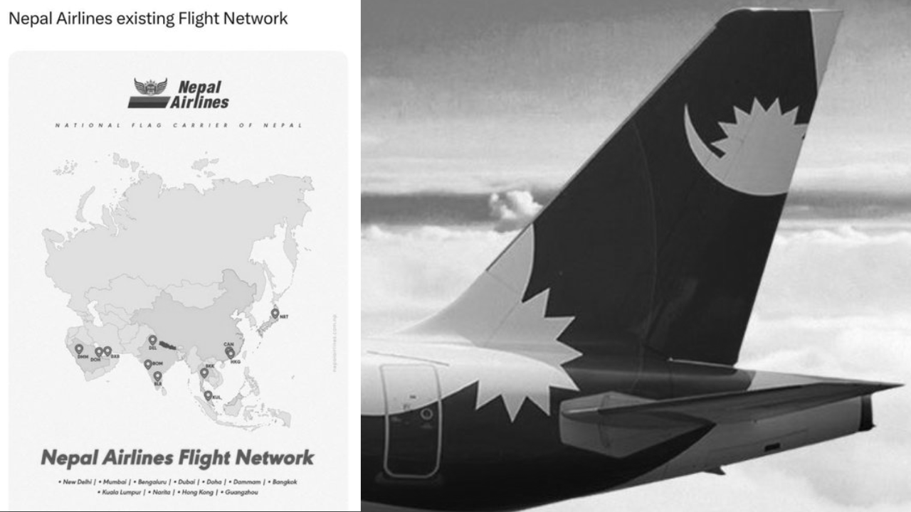
Nepal Airlines has issued a public apology after facing backlash over a network map shared on social media that showed Jammu and Kashmir as part of Pakistan , triggering controversy over what it described as cartographic inaccuracies .
The airline clarified that the disputed depiction was an error and does not reflect the official position of Nepal or Nepal Airlines . The map, which was part of a network route visual , was quickly flagged by users online for incorrectly representing international boundaries , leading to widespread criticism and its removal from social media platforms.
In its statement posted on X, the airline said: “We sincerely apologise for error in the network map recently shared on our social media channels. The map contained significant cartographic inaccuracies regarding international boundaries that do not reflect the official stance of Nepal or Nepal Airlines.”
Following the backlash, the airline promptly deleted the social media post and confirmed that an internal review has been initiated to ensure stricter verification of all future published materials.
The carrier also emphasised that it deeply values its relations with neighbouring countries and regretted any offence caused by the incorrect map representation.
According to additional details reported in the aftermath, the image circulated widely before being taken down, with users highlighting that the entire Jammu and Kashmir region had been placed within Pakistan’s borders , intensifying the criticism. The incident also sparked broader discussion online about the importance of accuracy in digital mapping and international boundary representation , especially for public-facing organisations.
The airline has not issued any further clarification beyond its apology and confirmation of corrective measures.